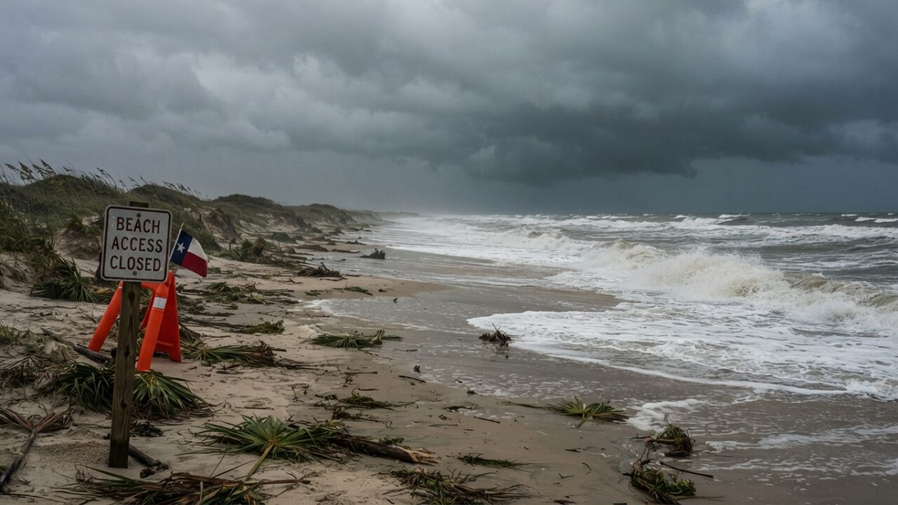
Tropical Depression Edouard has weakened significantly after making landfall along the Texas and Louisiana coast, but the storm system continues to pose serious flooding threats to barrier island communities and coastal regions. While wind speeds have dropped below tropical storm thresholds, meteorologists warn that the real danger now comes from persistent heavy rainfall that could overwhelm drainage systems and create dangerous conditions for residents and visitors.
The National Hurricane Center downgraded Edouard from tropical storm status as circulation patterns weakened over land. However, the system remains capable of producing several inches of rainfall across a broad swath of the coastal plain, raising concerns about flash flooding in low-lying areas where drainage infrastructure already struggles during normal heavy rain events.
Current Conditions Along the Barrier Islands
Port Aransas and neighboring barrier island communities experienced the initial impact as Edouard moved inland. The storm brought bands of heavy rain and gusty winds that knocked out power to thousands of customers. Utility crews have been working to restore service, but more than 65,000 customers remained without electricity as the system continued to dump rain across the region.
Beach access points have been closed in several areas due to high surf and dangerous rip current conditions. Local authorities emphasize that these closures remain in effect even as wind speeds decrease, since wave action and coastal flooding can persist for days after a tropical system passes.
The storm surge threat has diminished with the weakening of the system, but rainfall flooding has become the primary concern. Streets in low-lying neighborhoods have experienced standing water, and several causeways connecting barrier islands to the mainland have seen temporary flooding that complicated travel.
Rainfall Totals and Forecast
Meteorologists tracking the system report that some coastal locations have already received between four and eight inches of rainfall, with additional precipitation expected as the storm system slowly moves inland. The slow forward speed of Edouard has exacerbated flooding concerns, as the same areas continue to receive rain for extended periods.
Flash flood watches remain in effect for much of the coastal region, with particular attention to areas near Corpus Christi Bay, Aransas Bay, and the network of estuaries that characterize the central Texas coast. These shallow water bodies can overflow their banks when combined rainfall and tidal influences create compound flooding scenarios.
Forecast models suggest the remnants of Edouard will continue tracking northward, gradually spreading rainfall across eastern Texas and into Louisiana. However, the coastal region should expect intermittent heavy bands of precipitation through the next 24 to 48 hours before conditions begin to improve.
Impact on Coastal Wildlife and Habitats
The timing of this tropical system carries particular significance for coastal wildlife populations. Bird nesting seasons along the barrier islands are nearing their end, but late-season nesting sites could face inundation from the combination of high tides and heavy rainfall. Areas managed by wildlife refuges and conservation organizations will require assessment once floodwaters recede.
Coastal marshes and wetlands, while resilient to periodic flooding, can experience temporary disruption to wildlife movement patterns. Wading birds, shorebirds, and other species that depend on these ecosystems may shift to higher ground until water levels normalize. Biologists note that short-duration flooding events typically have minimal long-term impact on established wildlife populations.
Marine conditions will remain hazardous for days following the storm’s passage. Turbulent seas, reduced visibility in nearshore waters due to sediment runoff, and unpredictable currents make fishing and boating activities dangerous. Charter operations and recreational anglers should expect significant delays before conditions return to normal.
Preparing Gear and Property for Tropical Weather
The arrival of Edouard serves as a reminder that tropical weather season extends well into fall along the Texas coast. Property owners and outdoor enthusiasts who maintain equipment in coastal environments face ongoing challenges from salt exposure, high humidity, and periodic flooding events.
Boats and watercraft secured at marinas weathered the storm with minimal damage in most cases, though operators will need to inspect for water intrusion and check bilge pumps once conditions allow safe access. Trailer boats stored on properties should be checked for water accumulation and potential corrosion from the combination of rainfall and salt spray.
Fishing gear, camping equipment, and other outdoor items require careful attention after exposure to tropical systems. Reels and tackle should be rinsed with fresh water and dried thoroughly to prevent salt corrosion. Tents and tarps that experienced heavy rain need to be cleaned and dried to prevent mildew growth.
Travel Disruptions and Beach Access
Visitors planning trips to Port Aransas and surrounding communities should anticipate disruptions to normal activities. Beach access remains restricted in multiple locations, and park facilities may be closed for cleanup and damage assessment. Those with existing reservations should contact accommodations directly to confirm availability and assess current conditions.
The ferry system connecting Port Aransas to the mainland suspended operations during the peak of the storm but resumed limited service as conditions improved. However, schedules may continue to fluctuate based on weather conditions and operational assessments. Travelers should check current status before attempting to use ferry services.
Fishing piers along the coast closed ahead of the storm and will require inspection before reopening. Structural assessments focus on deck integrity, handrail security, and any damage to pilings from wave action. Popular fishing destinations like the Horace Caldwell Pier typically reopen within days of a tropical system passage, but timeline depends on findings from safety inspections.
Looking Ahead: Remaining Alert Through Hurricane Season
The development and landfall of Edouard highlights that tropical weather threats persist along the Texas coast through November. Water temperatures in the Gulf of Mexico remain warm enough to support tropical development, and atmospheric conditions can still favor storm formation despite the approach of fall.
Coastal residents and regular visitors should maintain readiness throughout the remainder of hurricane season. Emergency supplies, evacuation plans, and property preparation measures remain relevant. Past hurricane seasons have produced significant storms in October and even November, making complacency a risk.
Current forecast discussions indicate no immediate additional tropical threats, but monitoring systems in place continue to watch for any new areas of disturbed weather. The pattern that produced Edouard demonstrates that rapid development remains possible when atmospheric and oceanic conditions align.
Cleanup efforts will continue across the affected areas as floodwaters recede and power restoration progresses. Local authorities urge residents to report downed power lines, flooded roadways, and other hazards to appropriate agencies. Standing water can conceal dangers including debris, damaged pavement, and wildlife seeking refuge from flooded habitats.