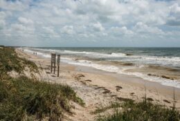
Tropical Storm Isaias continues to push northward after making landfall, bringing renewed attention to storm surge threats along the Texas Gulf Coast as residents enter the most active phase of hurricane season. While Isaias tracked up the Atlantic seaboard, the storm’s behavior offers critical lessons for barrier island communities from Port Aransas to South Padre Island.
The National Hurricane Center reported sustained winds and significant coastal flooding as Isaias moved inland, creating hazardous conditions that mirror risks Texas coastal residents face during tropical weather events. Storm surge, the abnormal rise of water generated by a storm’s winds, remains the greatest threat to life and property along the Gulf Coast.
Understanding Storm Surge Dynamics on Barrier Islands
Barrier islands along the Texas coast face unique vulnerabilities during tropical systems. The shallow continental shelf extending from shore amplifies surge potential, particularly when storm tracks align perpendicular to the coastline. Water pushed onto land can rise several feet above normal tide levels within hours.
Mustang Island and San Jose Island, which shelter Port Aransas and the Aransas Pass channel, sit at particularly exposed positions. During Hurricane Harvey in 2017, storm surge exceeded ten feet in some locations, inundating homes, damaging infrastructure, and reshaping beach profiles that took years to recover.
The timing of a storm’s arrival relative to astronomical tides compounds surge impacts. A hurricane making landfall during high tide produces significantly greater flooding than the same storm arriving at low tide. This tidal variance can mean the difference between water lapping at doorsteps and complete structural inundation.
Current Monitoring and Forecast Technology
The National Weather Service maintains a network of tide gauges along the Texas coast, providing real-time water level data during tropical events. These instruments measure subtle changes in sea level that can indicate developing surge conditions hours before peak impacts arrive.
The Coastal Emergency Risks Assessment, a mapping tool developed by NOAA, allows residents to visualize potential surge heights for their specific locations based on storm category and track. These maps reveal that even Category 1 hurricanes can generate life-threatening surge in vulnerable coastal areas.
Meteorologists track not just wind speed but also storm size when assessing surge potential. A large, slow-moving tropical system generates more sustained onshore winds, pushing greater water volumes toward shore regardless of maximum wind intensity. Isaias demonstrated this principle as it maintained tropical storm strength while producing significant coastal impacts.
Preparing Coastal Property for Tropical Weather
Property owners on Mustang Island and neighboring barrier islands face specific preparation challenges unique to the coastal environment. Salt spray carried by tropical storm winds corrodes standard building materials, requiring specialized hardware and protective coatings.
Hurricane shutters designed for Gulf Coast conditions must withstand not just wind pressure but also windborne sand and debris. Many Port Aransas residents install removable aluminum panels rather than permanent fixtures, balancing protection with the need to preserve ocean views during calm weather.
Elevation determines flood vulnerability more than any other factor. Homes built on pilings extending eight feet or higher above grade typically escape structural flooding during moderate surge events. Ground-level structures, even those constructed to code, face inundation risk during significant tropical systems.
Securing outdoor equipment presents particular challenges in coastal settings. Fishing gear, kayaks, paddleboards, and beach furniture become dangerous projectiles in hurricane-force winds. Residents learn to store these items inside or anchor them with systems designed to resist sustained winds exceeding 100 miles per hour.
Beach Access and Safety During Storm Approaches
Local authorities close beach access when tropical systems approach, typically 24 to 48 hours before tropical storm-force winds arrive. These closures protect both residents and emergency responders who would otherwise face rescue operations in dangerous surf conditions.
Rip currents intensify dramatically as tropical systems approach, even when storms track hundreds of miles offshore. The powerful currents extend well beyond visible breakers, pulling swimmers seaward faster than most people can swim against the flow. Several drownings occur along the Texas coast each hurricane season as visitors underestimate these hidden dangers.
Port Aransas Beach Patrol coordinates with the National Weather Service to post warning flags and disseminate safety information through social media channels. Red flags indicate water conditions too dangerous for swimming, while double red flags mean complete beach and water closure.
Wildlife Response to Tropical Systems
Coastal wildlife demonstrates remarkable adaptability to tropical weather patterns. Sea turtles, which nest on Texas beaches throughout summer, delay emergence during storm approaches. Hatchlings remain in their sandy nests until wave action and wind subside, then emerge in mass events called arribadas.
Shorebird populations temporarily relocate to inland areas as storms approach, returning within days of system passage. Researchers tracking banded plovers and terns document these movements, revealing that birds often travel inland along highway corridors before returning to reclaim beach territories.
Dolphin pods in the Lydia Ann Channel and surrounding bays move into deeper water as barometric pressure drops, a behavioral response that helps them avoid shallow water turbulence during peak storm conditions. Anglers report seeing unusual concentrations of marine life in ship channels and deep holes immediately before tropical system arrivals.
Post-Storm Beach Conditions and Recovery
Storm surge reshapes beach topography, often dramatically. Dunes that took years to build can wash away in hours, while new sand deposits appear in unexpected locations. The Texas General Land Office monitors beach profiles after major storms, tracking erosion patterns and planning restoration efforts.
Debris fields following tropical systems create both hazards and opportunities. Beachcombers find unusual shells and marine specimens deposited by storm surge, but also encounter dangerous items including damaged fishing gear, broken glass, and displaced infrastructure components.
Water quality testing intensifies after storms pass. Runoff from inland areas carries bacteria and pollutants into coastal waters, sometimes requiring temporary beach closures until bacterial counts return to safe levels. The process typically takes three to five days depending on currents and continued rainfall.
Resources for Storm Preparedness
The Texas Division of Emergency Management maintains comprehensive hurricane preparation guides specific to coastal counties. These resources include evacuation route maps, emergency supply checklists, and contact information for local emergency management coordinators.
Port Aransas operates a reverse notification system that alerts registered residents to evacuation orders and emergency information via text message and email. Registration requires only a phone number and email address, with no cost to participants.
Marine weather forecasts from NOAA provide detailed information about approaching systems, including predicted surge heights, wind speeds, and rainfall totals specific to coastal zones. These forecasts update every six hours during active tropical weather, with special statements issued when conditions change rapidly.
As Isaias continues its inland track, Gulf Coast residents monitor development in the Atlantic and Gulf basins. Hurricane season peaks in September, with several more months of potential tropical activity ahead.